
Muscogee Neighbor Block Sources
A block lookup works best as a set of narrow questions. GIS establishes which parcels touch. Assessor cards name assessed owners. A state voter file may contain structured residence rows, but it is incomplete and tightly limited. Historic maps and local groups describe community context rather than private households.
| Official or local source | What it reveals about a block | Access route |
|---|---|---|
| CCG GIS parcel layer | Touching parcels, lot shapes, aerial and district context | Public map gallery |
| Board of Assessors cards | Assessed owner, mailing and situs address, parcel facts | Free, parcel by parcel |
| County voter file | Structured address rows for registered voters | $70 county file; restricted lawful use |
| Planning and historic maps | District lines and contributing properties | CCG map resources |
| City-directory street sections | Earlier occupants along a block | DLG and library; years vary |
| Neighborhood organizations | Public officers, contacts, projects, and events | Public pages; no presumed roster |
No row is a complete resident list. Apartments may have one parcel owner and many unnamed households. A mailing address may differ from the property address. Treat those distinctions as part of the result, not as errors to smooth away.
Define Your Muscogee Neighbors
Choose the search boundary before collecting names. “Adjacent” should mean a parcel that shares an edge or corner. “Same block face” should mean properties on one side between two intersections. A distance search requires a fixed radius, yet the available CCG viewers do not promise one standard buffer tool. Map browsing is the documented method.
This choice matters in Muscogee County. Rear lot lines can create neighbors on another street. A corner parcel may touch three directions. One large school, church, apartment, or commercial parcel can break simple number order. Record the rule used so the block can be checked later.
Map Muscogee Neighbor Parcels
Open the Columbus Consolidated Government GIS gallery and choose a parcel-capable viewer. Search by address, owner, or parcel ID where that app permits. Layers differ among apps, but the research confirms parcel or cadastre outlines, aerial imagery, zoning, districts, and identify actions.
- Locate the target address and zoom until parcel boundaries are visible.
- Click the target parcel and save its parcel ID.
- Move clockwise, clicking every touching parcel, including corners and rear boundaries.
- Open each matching assessor card independently to confirm the owner and situs.
- Label the result as assessed ownership, not as a list of all residents.
The CCG Public Access property search supplies the card. Its sale history and exemption fields can add context, but a homestead indicator only supports owner occupancy. For an entire named road rather than an immediate block, use the Muscogee County street directory workflow.
Separate Muscogee Neighbor Records
The assessed owner is the person or entity on the certified property roll. The situs address is the land. The mailing address receives tax notices. Matching situs and mailing addresses, together with a homestead notation, may support an owner-occupancy conclusion. None of those fields identifies every household member.
Different mailing and situs addresses do not prove that a house is empty or leased. Trusts, estates, and companies may hide the name of a person connected to title. Apartment parcels are even less suited to neighbor identification because one ownership card may cover scores of units. Commercial neighbor databases often merge these roles and can attach a deceased owner or prior resident to the wrong unit.
Key distinction. Muscogee property rolls describe parcels and assessed owners; they do not publish a complete household roster.
Muscogee Neighbor Voter Limits
Georgia's My Voter Page authenticates one voter using identifying details. It is not a public street browser. The Secretary of State separately offers electronic county voter lists. The file layout separates house number, street direction, name, type, apartment, city, and ZIP, which can support lawful grouping by a block.
A Muscogee County file costs $70 according to the researched order materials. Commercial use is prohibited by O.C.G.A. §21-2-601. Georgia VoteSafe masks qualifying residence addresses, and unregistered people are absent. Participation history shows election dates or types, never how anyone voted. These limits make the file unsuitable as an unrestricted directory of your neighbors.
Note: Never infer that a missing voter row means an address is vacant or that no eligible person lives there.
Muscogee Neighbor Community Contacts
Neighborhood groups add a voluntary layer. Official public pages tend to publish officers, event contacts, and projects, not member names. No authoritative CCG directory of every active association was found, so current status should be confirmed with Planning or the organization before a name is presented as active.
| Community context | Useful public record | What not to assume |
|---|---|---|
| Uptown / downtown riverfront | Historic district and development contacts | Every property owner is a member |
| Dinglewood, Wynnton, St. Elmo | Preservation maps and historic resources | A preservation contact is a resident roster |
| Bibb City | Mill history and Sanborn coverage | Old mill occupancy remains current |
| East Highland, Midtown, North Highlands, Rose Hill | Civic and planning context | Every local group publishes members |
| Oakland Park, Benning Hills, Fortson / Green Island | Parcel, planning, and event contacts | Postal labels equal neighborhood borders |
Keep Columbus Beautiful and Adopt-a-Spot groups may reveal public project contacts. Congregation rolls, block-watch lists, and private social groups are not public merely because they serve a neighborhood.
Muscogee Neighborhood History Records
Planning and preservation maps can explain why a block looks unlike its street numbers. Historic district lines, contributing-property records, plats, and aerials describe development patterns. They do not identify all current residents. The best use is to understand lot shape, building age, and a community's name.
Bibb City is a mill community covered by the 1929/1958 Sanborn volume. North Commons research used directories and maps to recover a predominantly African-American neighborhood. Wynnton and St. Elmo favor older directories, plats, and Sanborn sheets, while later North Columbus and eastern subdivisions lean more on assessor cards, plats, and permits.
Compare Muscogee Neighbor Rolls
Official sources and commercial neighbor tools have different strengths. The official custodian tells you what a specific dated record says and provides a correction route. Commercial products blend public and marketing data, often without exposing the date or match logic.
| Question | Official record | Commercial category |
|---|---|---|
| Who owns this parcel? | Assessor card, confirmed by deed | May show stale or prior owner |
| Which lots touch? | GIS parcel geometry | May rely on address distance |
| Who is registered here? | Authorized voter record with legal limits | May mix old and marketed data |
| How is an error fixed? | Contact the record custodian | Opt-out or correction rules vary |
Use the assessor for parcel facts, the deed for title, and the relevant custodian for corrections. A commercial compilation cannot override VoteSafe or turn a clue into official proof.
Request Muscogee Neighbor Records
When an existing city or county record is not online, Georgia's Open Records Act supplies a fallback. Direct a narrow written request to the custodian. Ask for an existing index, map, case list, or document, not for staff to research a block or create a new compilation. If records are not immediately available, the agency response is due within three business days and may include a time and cost estimate.
The Georgia open-records request portal illustrates the request fields and timing.
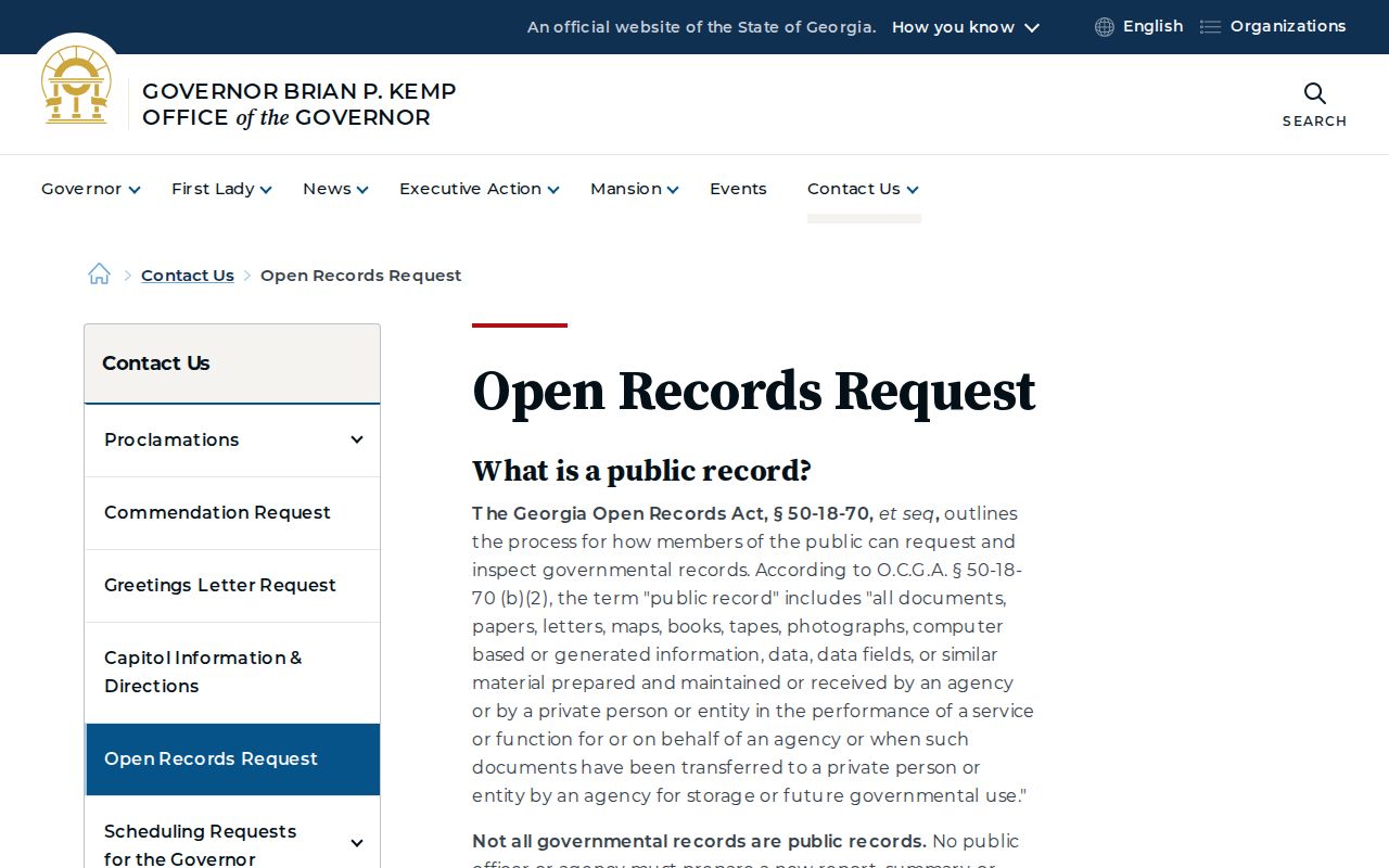
The captured page reinforces the key limit: agencies provide existing nonexempt records and need not build a custom neighbor list.
Muscogee Neighbor Safety Records
Personal safety questions should use an official statewide source and current details. The Georgia Bureau of Investigation registry page explains the state's official registry service.
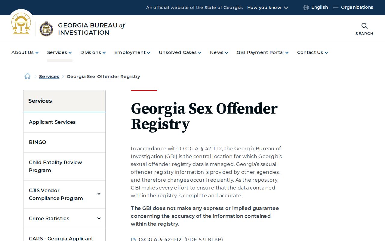
The image connects users to the custodian rather than a copied or stale commercial list. Follow the registry's own warnings and do not treat an old address or case as proof of a person's present location or risk.
Respect Your Muscogee Neighbors
Private utility, delivery, motor-vehicle, protected voter, sealed court, and confidential vital data do not become public because someone wants a fuller block list. Non-owner household members may never appear in an official public record. That absence is a privacy boundary, not a problem to bypass.
Record dates, distinguish assessed owners from residents, and omit protected addresses. Contact a neighbor directly through ordinary, respectful means when appropriate. Public records should support civic knowledge and personal safety, not surveillance.
Lawful use. Never use a Muscogee County neighbor lookup to watch, intimidate, stalk, harass, or harm another person.